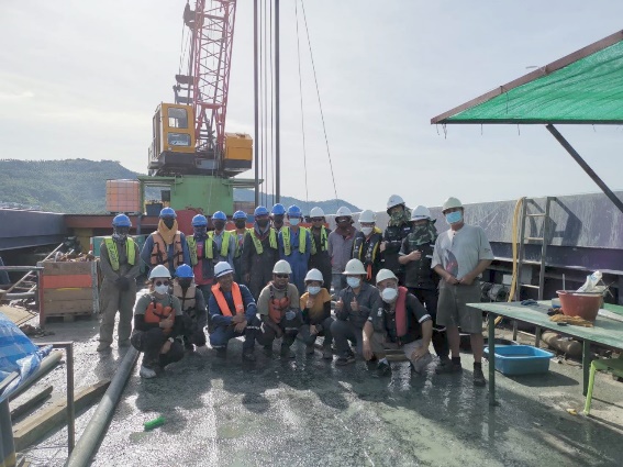
Survey & Inspections

Integrated survey and inspection services — geophysical surveys, pipeline inspection, and asset integrity assessments.

Overview

Accurate Data. Engineering-Grade Insights.

JST delivers integrated survey and inspection solutions across land, subsea, and aerial environments. By combining advanced technologies — including Drones, LiDAR, AI, and ROV systems — with field expertise, we provide accurate, reliable data and transform it into actionable insights that support engineering decisions and asset integrity.

The Challenge We Solve

Incomplete, inconsistent, or fragmented survey data creates risk across every phase of an asset's lifecycle.

  • !
    Limited visibility of subsea, land, or aerial conditions
  • !
    Data inconsistency impacting engineering decisions
  • !
    Difficulty verifying asset condition and integrity
  • !
    Fragmented survey, inspection, and reporting processes
Our Approach

Structured. Technology-Driven. Reliable.

JST applies a four-stage methodology to ensure every survey and inspection programme delivers data that meets engineering standards.

01

Integrated Data Acquisition

Multi-platform data capture across subsea (ROV, sonar), aerial (Drone, LiDAR), and land (GPS, RTK) environments.

02

Advanced Processing & Modelling

Transformation of raw data into high-resolution geospatial models and structured datasets.

03

Engineering Analysis

Interpretation of survey and inspection data to identify risks, conditions, and performance indicators.

04

Inspection & Verification

Validation through visual inspection, NDT, and field verification to ensure data accuracy.

Solution Scope

Survey & Inspection Capabilities

Four integrated service lines covering subsea, aerial, land, and integrity disciplines — delivered as standalone services or as part of a multi-domain programme.

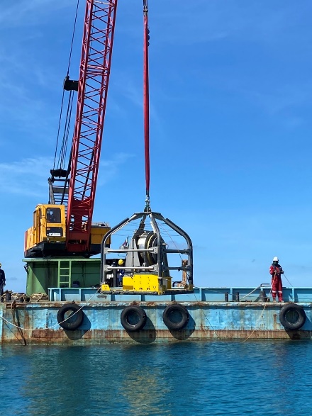
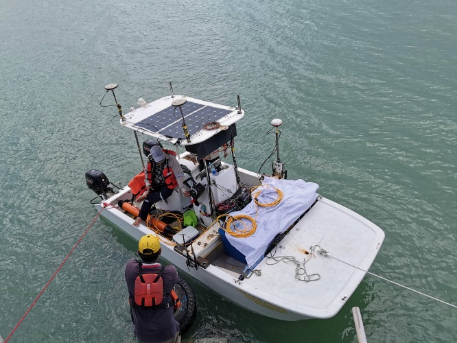
Hydrographic & Subsea Survey

Bathymetric surveys, side scan sonar, geophysical surveys, and ROV inspection services for subsea and offshore assets.

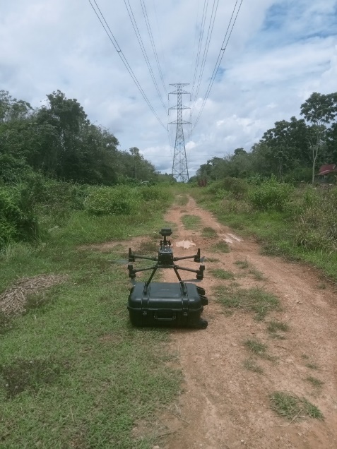
Aerial & Drone Survey

Photogrammetry, LiDAR mapping, AI-assisted inspection, and aerial data acquisition for rapid, large-area coverage.

Land Survey & Geospatial Mapping

GPS and RTK surveys, well site surveys, and cartographic mapping for onshore projects and infrastructure planning.

Inspection & Integrity Services

Pipeline inspection, structural inspection, NDT, and integrity assessment support to manage risk and extend asset life.

Where It Fits

Part of JST's Integrated Capability

Survey & Inspection works alongside JST's broader service offering — providing the foundational data layer that enables safe, well-informed operations across every discipline.

Marine & Offshore Operations
Accurate Planning & Execution
Supply & Communication Systems
Lifecycle & Integrity Management
Applications

Where We Work

Pipelines
Offshore Assets
E&P Projects
Infrastructure Development
Marine Construction
Featured Projects

Recent Survey & Inspection Work

Marine and aerial survey programmes delivered for energy and utility operators across Thailand.

Electricity Generating Authority of Thailand (EGAT) — Marine Survey
Marine Survey · Oct 2021

Electricity Generating Authority of Thailand (EGAT) — Marine Survey

Submarine cable route survey for the 230 kV Khanom – Ko Samui Submarine Cable System Project. Data collected to support design and construction of the route from Khanom HV Substation to Ko Samui HV Substation, Surat Thani.

J-Power — Marine Survey
Marine Survey · Dec 2024

J-Power — Marine Survey

DTS and route survey for installation of the HVAC submarine cable system from Khanom HV Substation (Nakhon Si Thammarat) to Ko Samui HV Substation (Surat Thani), part of EGAT's 230 kV Khanom – Ko Samui Submarine Cable System Project.

Provincial Electricity Authority (PEA) — Marine Survey
Marine Survey · Jul 2019

Provincial Electricity Authority (PEA) — Marine Survey

Physical characteristics and geographic coordinate survey for 22 kV submarine cable routes: Khao Laem Ya – Koh Samet (Rayong, ~5 km) and Laem Ngop – Koh Chang (Trat, ~6 km).

Electricity Generating Authority of Thailand (EGAT) — Aerial Survey
Aerial Survey · Dec 2023

Electricity Generating Authority of Thailand (EGAT) — Aerial Survey

Contracted UAV inspection of transmission towers, high-voltage line equipment, and right-of-way areas for maintenance planning. Coverage included the 230 kV Bang Saphan – Chumphon line (36.65 km, Prachuap Khiri Khan and Chumphon) and the 230 kV Thung Song – Khlong Ngae line (20.38 km, Phatthalung).

Speak to Our Team

Delivering data you can rely on — when it matters most.